CAMBRIDGE, Md. — The road through Blackwater National Wildlife Refuge on Maryland’s Eastern Shore could be Ghost Tree Way for the story it tells about how invading saltwater above and below ground is killing vegetation and redesigning coastal lands.
From the mid-Atlantic to the Gulf of Mexico, salt is killing groves of trees from the roots up. Advancing water is pressing landowners and farmers into wrenching decisions and is challenging conservationists to find corridors for marshes to survive.
Stemming the saltwater invasion is not possible, researchers say. The aim now is to adapt to the continued resculpting of coastlines by finding crops that can thrive with salty feet and by maintaining marshes as long as possible for their many benefits, including reducing property damage during increasingly frequent storms.
The Howard Center for Investigative Journalism at the University of Maryland deployed drones, analyzed satellite imagery and interviewed dozens of scientists to document the transformation, which is happening more quickly than experts had projected.
Salt is the leading edge of climate change, an early harbinger that is threatening millions of dollars worth of storm protection as well as coastal ecosystems like Blackwater’s. Before the pandemic, scientists from Russia, China, South Korea, Vietnam or Europe would arrive every few months at Blackwater, the so-called “Everglades of the North,” for a glimpse of their future.
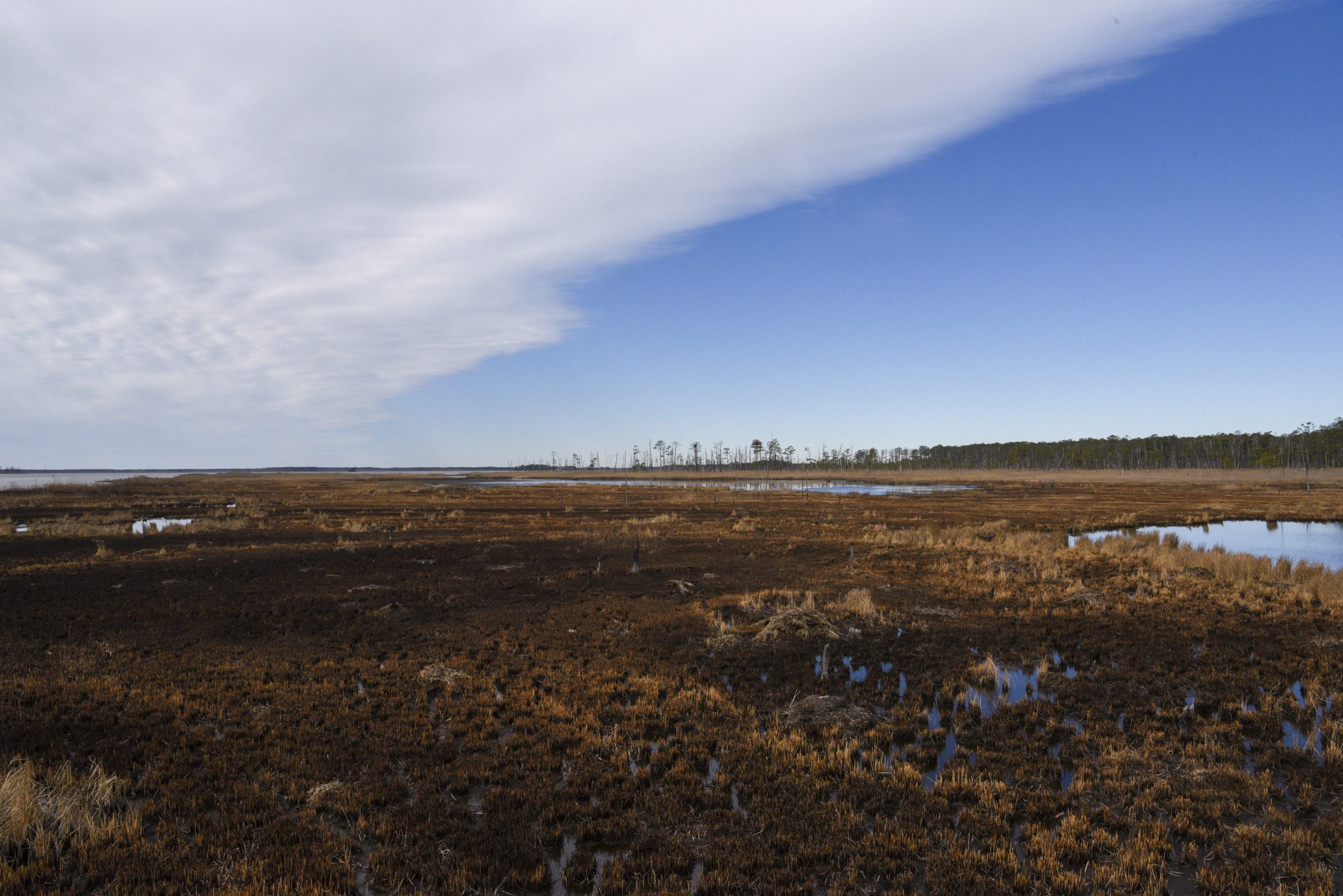
In 28,000-plus acres between the Atlantic Ocean and Chesapeake Bay, Blackwater encompasses a half-dozen ecosystems of the Chesapeake region, from rivers to wetlands to forests. Since its founding in 1933, Blackwater has lost over 5,000 acres of its marsh lands to open water as the refuge basically collapses from within.

Sea rise at Blackwater is accelerated because of subsidence along the Mid-Atlantic that began after the last ice age. The sped-up transition has created more of one ecosystem — about 3,000 acres of upland marsh — at the expense of forests.
“Blackwater is a living case study of the impacts of sea level rise. People come here to see dead forests right in front of their eyes,” said Matt Whitbeck, Blackwater’s supervisory wildlife biologist, gazing out over a dying marsh and tree skeletons on the horizon.
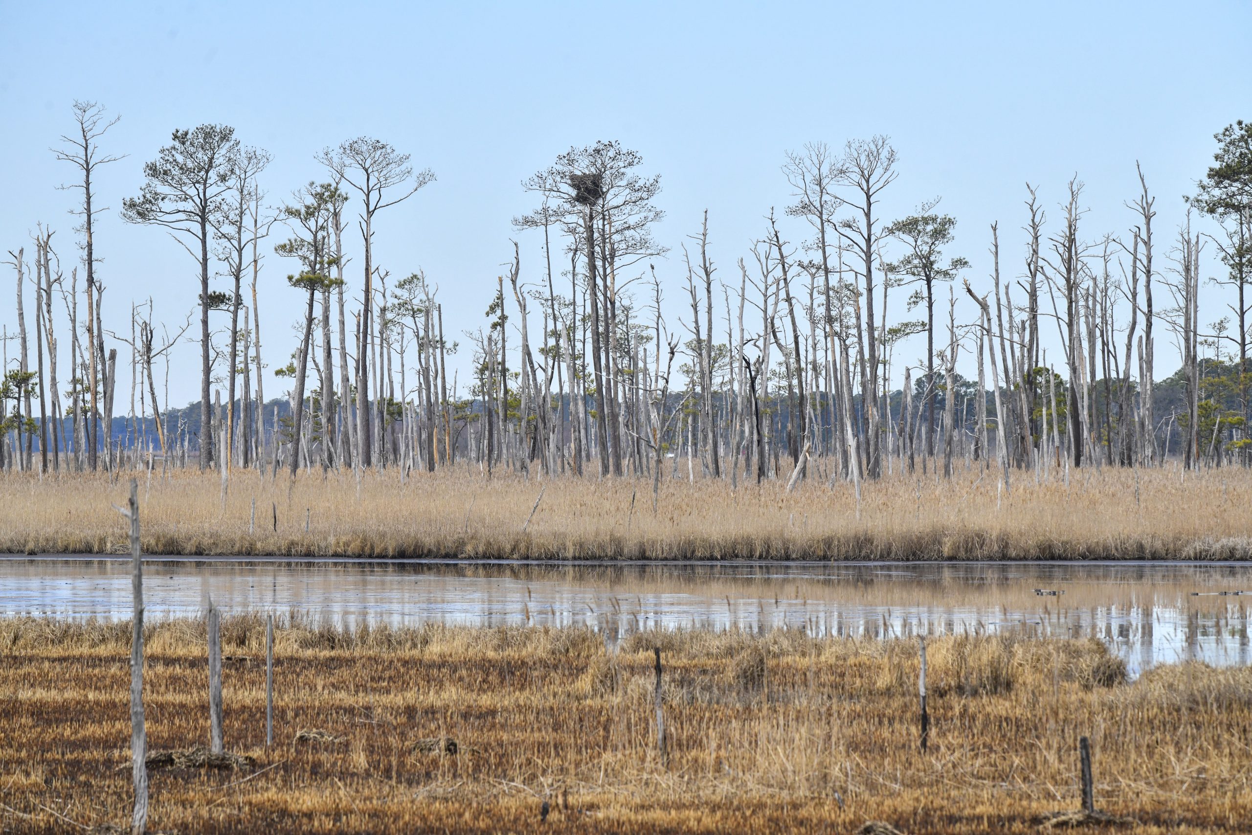
Tree after tree, Blackwater’s oaks, maples and American sweetgums have succumbed to the saltwater, leaving stands of the last to go, loblolly pines, dead and bleaching in the sun.
South and east of Blackwater, on Maryland’s lower Eastern Shore, tree loss is so widespread that the Maryland Department of Agriculture now classifies saltwater intrusion as a pest — along with the gypsy moth, emerald ash borer and other hostile invaders.
Surveying forests by air in 2017, the state of Maryland found 13,096 acres of forest in four shore counties affected by saltwater.
A year later, aerial surveys over the same territory showed an increase in mortality; saltwater was afflicting 41,094 forest acres — the vast majority in Dorchester County, where Blackwater is located.
“I’ve been here 37 years and seen dramatic results from so much saltwater,” said Scott Daniels, a Dorchester County-based forester at the Maryland Department of Natural Resources. “I don’t think this area will ever again produce another quality stand of timber.”
Salt-killed trees bleach in the sun on the Eastern Shore of Maryland. (Willey’s Drone Service/Cambridge, Md.)
‘Big problem’
Trees absorb water through their roots. Salt reverses the process, drawing water from the plants, disrupting the flow of minerals and the capacity to convert light to energy. Even small doses of saltwater stunt growth, researchers say.
Farming has made it worse. In North Carolina, research by ecologist and biogeochemist Marcelo Ardón shows how saltwater travels the ditches and canals dug over the years to drain freshwater from croplands.
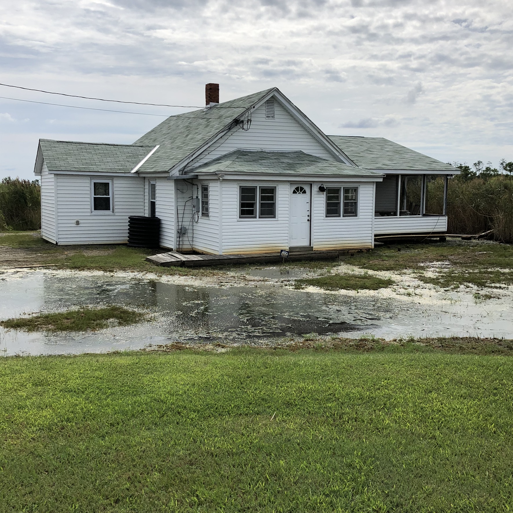
Now, patchworks of ditches carry saltwater inland from storms and invading seas, killing trees before poisoning farmland.

Ardón, an associate professor at North Carolina State, is wrapping up work under a five-year National Science Foundation grant to take stock of saltwater’s impacts on the Albemarle-Pamlico Peninsula. That vast stretch of forested wetlands, pine forests and cropland is separated from the Atlantic Ocean by barrier islands.
Ardón and his colleagues are seeking early warning signs of tree mortality by using satellite imagery to measure their “greenness,” he said.
In research not yet published, Ardón said they found salinity increasing everywhere on the peninsula more swiftly than expected.
“I think the realization that this is a big problem is still happening,” he said.
Along the Albemarle-Pamlico, ghost forests are expanding rapidly. In newly published research, Lindsey Smart, a research associate at North Carolina State’s Center for Geospatial Analytics, found striking changes in the forest landscape: roughly 15% of a 65-square-mile area of the peninsula changing from healthy forest into ghost forest.
“It’s all about identifying these areas that, hey, this might be a resilient coastal forest site, let’s help protect it. Or hey, this coastal forest site is just too far gone, let’s facilitate marsh migration into this area,” said Smart, who has gone door to door interviewing farmers and landowners.
Rick Savage, a former wetlands researcher for the state of North Carolina, says that deeply ingrained farm practices are tough to overcome.
“The mindset of too many people on the coast is that we’re getting flooded and we need more ditches, because that’s what we’ve always done in the past,” Savage, founder of the advocacy group Carolina Wetlands Association, said last spring.
He sounded more hopeful in September after setting in motion two potential marsh projects, one removing a dam that harms wetlands by blocking water flow and the other a restoration plan in a community weary of flooding.
“It seems like the message is getting out, that it’s starting to happen,” he said.
Paul Taillie, a postdoctoral researcher at the University of Florida, finds silver linings. He has published research showing how stands of dead trees along the North Carolina coast offer habitat for birds, among them woodpeckers and a type of warbler. The loss of tree canopy also lets in light that spurs the growth of grasses and shrubs more tolerant to salt.
“In the scientific literature and in the media, it seems like most of what you read about climate change tends to be the negative consequences for animals and ecosystems,” he said. “I feel like I’m one of the only people pushing this idea of conservation benefits.”
In South Carolina, cypress trees at the Waccamaw National Wildlife Refuge are victims of “estuary creep,” says refuge manager Craig Sasser.
Arguing a successful case last year to expand Waccamaw’s boundaries by about 7,000 acres to offset losses, Sasser highlighted threats from habitat loss to the swallow-tailed kite, a sleek raptor that Audubon calls the most beautiful bird of prey.
“We blinded them with good science,” Sasser said.
Trees are dying by saltwater in much the same way on the Gulf Coast along the Suwannee River, which runs from the Okefenokee Swamp in Georgia to the Florida Panhandle.
The region of swamps and thin soils over limestone rock was historically rich in tree canopy.
But its green islands of trees are disappearing, says David Kaplan, who heads the H.T. Odum Center for Wetlands at the University of Florida.
“The pines, oaks, cedars and palms have this orderly trajectory of death based on who can hack it in a saline environment and who can’t. One of the last remnants are the palms; you have all these dead palm sticks that are the last to go,” he said.
‘Managed retreat’
A study published in March in the proceedings of the National Academy of Sciences estimated the value of a square kilometer of wetlands at $1.8 million a year — for storm protection alone.
Another study in Delaware two years ago put the overall value of wetlands along its coast at $1 billion to $3 billion yearly — factoring in benefits to water quality, recreation and tourism.
The inexact science of valuing nature may need to sharpen as wetlands disappear and conservation budgets are hollowed out by the pandemic.
The U.S. Fish and Wildlife Service estimated Blackwater National Wildlife Refuge contributes nearly $8 million to the local economy, factoring in jobs, tax revenue and spending by 223,000 visitors.
As rising water floods in, Blackwater is devising ways to keep marshes alive, prolonging their many benefits, including storm protection and storing carbon.
Four years ago, refuge managers began a project to raise the elevation of 40 acres of deteriorating marsh. Using money from a hurricane relief fund, contractors sprayed the acreage with 26,000 cubic yards of sediment dredged from the Blackwater River, then replanted it with native grasses. In September, drone footage showed the marsh to be lush with foliage.
Yet that strategy, called thin-layering, is likely too costly to be widely accepted. At Blackwater, the price tag was $1 million.
A better strategy, scientists say, is paving the way for new marshes as old ones convert to open water. At Blackwater, Fish and Wildlife added 2,700 acres of private land to its marsh-migration resiliency plan. In February, work began that will guide nature as rising seas transform land into marshes.

Blackwater purchases are paid for in large part by the sale of Federal Duck Stamps, $25 conservation revenue stamps produced annually by the U.S. Fish & Wildlife Service that support wetlands protection by purchasing and leasing land or acquiring easements. In June, purchase of another tract of 438 acres 10 miles to the east extended the refuge. About half tidal marsh and half forest, the land is ripe to accommodate new marsh created as rising seas submerge old wetlands on their rush inland.
The federal agency made its purchases despite pockets of local opposition, said Marcia Pradines, a Fish and Wildlife biologist who manages Blackwater and other refuges in Maryland and Virginia.
“Not everybody loves the government buying up land,” she said.
In the strategy of managed retreat, said the Conservation Fund’s Erik Meyers, a partner in the planning, “What we’re after is the persistence of a functional marsh, not a preservation of what is now. There’s not enough money in the world to keep the sea at bay over a vast area.”


You must be logged in to post a comment.